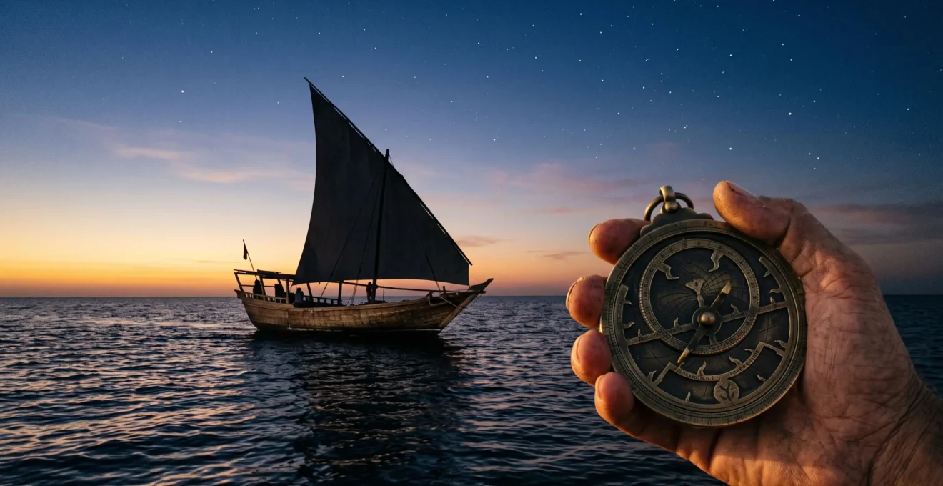
The transformation of global trade was not merely enabled by better tools, but by a revolutionary Arab navigational science that systematically ‘de-risked’ long-distance travel.
- This was achieved through a rigorous system of cross-verification, using multiple, independent data points from the stars, the sun, and the surrounding environment.
- Instruments like the astrolabe were not just tools but platforms for a culture of iterative scientific correction, constantly refining the accuracy of position-finding.
Recommendation: Understanding this history requires seeing navigation not as a simple craft, but as the era’s most advanced information science, one that turned uncertainty into a computable, and therefore manageable, risk.
To stand at the edge of the Arabian Sea or the Rub’ al-Khali, the Empty Quarter, is to face a void of overwhelming scale. For centuries, the thought of crossing these expanses was a venture into the unknown, guided by hope and landmark. Many assume that the history of navigation is a simple story of tools—the compass, the star chart, the astrolabe. They believe Bedouins possessed a mystical connection to the desert and sailors a sixth sense for the sea. This romantic view, however, misses the fundamental revolution that occurred.
The true story is not one of singular tools or innate gifts, but of a systematic, scientific methodology. The critical breakthrough in Arab culture was framing navigation as a problem of data processing. It was about creating a robust, multi-layered system of cross-verification where information from the stars, the sun, the wind, and even the shape of sand dunes was integrated to produce a single, reliable output: one’s position on Earth. This was not merely about avoiding getting lost; it was about making long-distance travel predictable, repeatable, and therefore, economically viable.
This article will deconstruct this ‘science of position’. We will explore how this systematic approach enabled trade routes that were previously unsustainable, dissect the specific techniques used to combine celestial and terrestrial data, and examine why this precision was not just an advantage, but the primary engine of profitability and discovery. By analysing the tools and, more importantly, the intellectual framework behind their use, we reveal how an entire economic and cultural epoch was built upon the ability to know, with certainty, exactly where you were.
This exploration will be structured to first establish the economic imperative for precision, then to detail the methods used at sea and on land, and finally to examine the pinnacle of this technology, the astrolabe, as the ultimate expression of this scientific system. The following summary provides a roadmap of our journey through this transformative history.
Summary: The Science of Position: How Precise Navigation Transformed Global Trade
- Why Did Precise Navigation Enable Trade Routes Inaccurate Methods Could Not Sustain?
- How Did Navigators Combine Star Charts With Sand Compasses?
- Precise Navigation or Rough Estimation: Which Generated Higher Profits?
- The Star Identification Error That Causes Total Loss Of Direction?
- When Should Desert Caravans Launch Before Dawn Rather Than Sunset?
- Why Does The Astrolabe Measure Latitude More Accurately Than Early Compasses?
- How Did Bedouin Navigate 1,000 Miles of Featureless Sand Without Compasses?
- Why Did Astrolabes Become The Most Precise Navigation Tool Before The Telescope?
Why Did Precise Navigation Enable Trade Routes Inaccurate Methods Could Not Sustain?
Trade is fundamentally a game of managing risk. A single lost cargo could bankrupt a merchant, and a route that is only successful 50% of the time is not a trade route—it’s a gamble. Early navigation, reliant on following coastlines (‘cabotage’) or waiting for perfect weather, was inherently limiting. It confined trade to known paths and seasonal windows, making it slow, small-scale, and high-risk. The Arab maritime revolution was driven by a methodology that directly addressed this economic constraint. By developing a system to reliably determine position in the open ocean, they transformed ‘gambles’ into calculated, repeatable voyages. This system was so effective that, for roughly eight centuries, from the 7th to the 15th, Arab seafarers dominated maritime commerce across the Indian Ocean.
The crucial difference was the ability to cross-verify. While other mariners relied on a single input, like a primitive compass or dead reckoning, Arab navigators layered multiple, independent data sources. This created a system of checks and balances that dramatically reduced the margin of error. The legendary 15th-century navigator Ahmad Ibn Mājid articulated this advantage with pointed confidence when comparing his methods to those of European sailors:
We have the measurement of stellar altitudes, but they have not… only the compass and dead reckoning.
– Ahmad Ibn Majid, Big History Project / OER Project – The Lion of the Sea
This “measurement of stellar altitudes” was the key to unlocking the open ocean. It allowed for the calculation of latitude, providing a fixed reference point far from any visible landmark. The sustainability of this model was not just theoretical. The Jewel of Muscat project, a full-scale reconstruction of a 9th-century Arab dhow, proved the point empirically. In 2010, it successfully sailed from Oman to Singapore using only historical instruments and techniques, demonstrating that these ancient, long-distance open-ocean routes were not just possible, but reliably repeatable. This repeatability is the bedrock of sustained trade, turning perilous journeys into predictable supply chains.
How Did Navigators Combine Star Charts With Sand Compasses?
The term “sand compass” is a poetic descriptor for a system of knowledge that treated the desert landscape with the same analytical rigour as a star chart. The genius of Arab navigation, both at sea and on land, was its ability to integrate disparate forms of information into a cohesive directional strategy. It was never about a single magic tool, but about a process of constant cross-referencing. At sea, a navigator would use an instrument like a kamal—a simple but effective wooden tablet on a string—to measure the altitude of Polaris (the North Star) above the horizon. This measurement gave him his latitude. Simultaneously, he would observe wind patterns, swell direction, and the flight of birds, comparing these terrestrial clues to the celestial data.
This layering of methods created a robust system resilient to the failure of any single component. As a detailed analysis of Arab traditional sea navigation techniques shows, the kamal was often used in conjunction with the more sophisticated astrolabe and a deep, multi-generational understanding of monsoon wind cycles. This created multiple independent checks on a vessel’s position. This methodology, this intellectual framework, was the true “compass.” The legendary navigator Ahmad Ibn Mājid summed up this toolkit not as a single item, but as a collection of intertwined systems: “We have 32 rhumbs, and tirfa, and zam, and the measurement of stellar altitudes, but they have not.” Each of these terms represents a distinct and complex system of knowledge, from dividing the horizon to timekeeping and celestial measurement.
Precise Navigation or Rough Estimation: Which Generated Higher Profits?
The question is almost rhetorical: precision in navigation directly translates to higher profits by minimizing the three greatest costs in long-distance trade: time, loss of cargo, and uncertainty. A voyage based on rough estimation is beholden to coastlines and predictable seasons, adding weeks or months to a journey. A ship that can take a direct, open-ocean shortcut arrives faster, completes more voyages per year, and gets its goods to market before its competitors. This time-saving, multiplied over fleets and decades, represents an enormous economic advantage. This precision wasn’t developed in a vacuum; it was a product of the intellectual ferment of the Islamic Golden Age, a period of scientific flourishing spanning roughly six centuries from the 8th to the 14th century, where investment in astronomy and mathematics paid direct commercial dividends.
More critically, precision re-prices risk. A captain confident in his position is more willing to sail in less-than-ideal conditions or explore new routes. This confidence, born of superior knowledge and technology, was a palpable source of power and respect. As Ahmad Ibn Mājid noted of his crew’s relationship with other mariners, “We can easily sail in their ships and upon their sea, so they have great respect for us.” This wasn’t mere boasting; it was a statement of a clear, profitable, and defensible competitive advantage. A lower risk of getting lost meant lower insurance costs, greater access to financing, and the ability to carry higher-value goods.
The operational differences between these two approaches are stark, impacting every aspect of a voyage from planning to execution. An analysis of traditional sea navigation techniques highlights these key distinctions.
| Factor | Precise Navigation (Kamal/Astrolabe + Zij) | Rough Estimation (Winds/Landmarks only) |
|---|---|---|
| Route flexibility | Could adjust for off-season winds and open-ocean shortcuts | Limited to familiar coastal routes tied to monsoon timing |
| Position confirmation | Cross-checked with stellar altitude measurements | Relied mainly on dead reckoning and visible landmarks |
| Risk exposure | Reduced uncertainty on unfamiliar open-sea passages | Higher risk of drift and delay on unfamiliar waters |
The Star Identification Error That Causes Total Loss Of Direction?
The idea of a single, catastrophic star identification error leading to total disaster is a compelling narrative, but it fundamentally misunderstands the nature of this navigational science. The system was not brittle; it was robust. It was designed with the assumption of potential errors and incorporated methods for their detection and correction. The risk of misidentifying a star was mitigated by looking at constellations, not just individual stars, and by taking multiple readings over time. A single anomalous reading would be flagged by the system’s inherent redundancy. A navigator was not just a tool-user; he was a scientist constantly testing his hypothesis—”I am here”—against incoming data.
This scientific mindset of continuous improvement is the true answer to the question. Instead of a system collapsing from one error, the history of Arab navigational science is one of iterative correction. This is perfectly illustrated in the development of the astrolabe itself. Far from being a static, infallible device, it was constantly being refined. For example, in the 11th century, the Andalusian astronomer Al-Zarqali dramatically improved the instrument by creating the universal astrolabe (the Saphaea). Critically, his work was not done in a vacuum; it explicitly built upon and corrected the earlier designs of his predecessors. This process shows a culture that actively sought out and fixed inherited measurement and calibration errors, rather than treating its tools as sacred relics.
This is the opposite of a system vulnerable to a single point of failure. The real “error” would have been to stop questioning, to stop refining, to stop cross-verifying. The strength of the system was its inherent scepticism and its built-in capacity for self-correction. It was a living science, not a fixed dogma, which is why it remained so effective for so long.
When Should Desert Caravans Launch Before Dawn Rather Than Sunset?
The decision of when to travel in the desert, like at sea, is a complex calculation based on multiple variables, not a simple preference. The choice between a pre-dawn or post-sunset departure depends on the specific goals of the journey leg: temperature management, celestial visibility, and the use of the landscape itself as a navigational tool. Launching before dawn allows the caravan to take advantage of the coolest part of the day, covering significant ground before the sun’s heat becomes dangerous. This timing also provides a clear view of the eastern horizon for a precise directional bearing from the rising sun, and the caravan would have spent the night guided by the stars, as one modern Emirati traveller noted, “at night the stars guide our track.”
Conversely, a sunset departure allows the caravan to orient itself with a known western bearing and travel through the cooler evening and night. However, the most sophisticated navigation integrates these celestial cues with terrestrial ones. A key piece of environmental data used by Bedouin navigators is the structure of the sand dunes themselves. As desert guide Sam McConnell explains, “Sand dunes form at 90 degrees to the prevailing wind.” An experienced guide knows the direction of the prevailing seasonal winds (like the Shamal) and can therefore use the orientation of the dune crests as a massive, landscape-sized compass, even in complete darkness or in a sandstorm when stars are not visible.
The ultimate decision, then, is a synthesis. As field accounts of Bedouin travel describe, the decision on a safe departure window was a constant process of integration. A caravan leader might use the sunset to get his initial west-bearing, travel through the night using the stars and the feel of the wind, cross-check his direction against the dune-lines, and then use the rising sun to confirm his eastern bearing, all while managing the heat and energy of his animals and people. It is not a question of “either/or” but “how to combine all.”
Why Does The Astrolabe Measure Latitude More Accurately Than Early Compasses?
Comparing an astrolabe to an early compass for measuring latitude is like comparing a scale to a ruler for measuring weight—they are designed for different, though related, tasks. A magnetic compass indicates direction (a bearing), while an astrolabe is a multifunctional astronomical computer. One of its primary navigational functions is to measure the altitude of a celestial body above the horizon. By measuring the height of Polaris (the North Star) in the Northern Hemisphere, a navigator could determine his latitude with a high degree of accuracy. This measurement is based on a fixed astronomical reality and is not subject to the same errors as a magnetic compass.
An early magnetic compass, while a revolutionary tool for maintaining a heading, suffers from several accuracy problems. Firstly, it points to the magnetic north pole, not the true geographic north pole, a deviation that varies depending on one’s location on Earth (magnetic declination). Secondly, large deposits of iron ore on land or the iron components of a ship itself could cause significant local deviations. The astrolabe’s measurement of latitude, by contrast, is absolute. The altitude of the stars is a constant, unaffected by terrestrial magnetism. This gave sailors a reliable way to fix their north-south position, a crucial coordinate for open-ocean travel.
The sophistication of the astrolabe is a testament to the scientific culture that produced it. The earliest known surviving physical astrolabe, crafted in Iraq in 927-928 CE, demonstrates a remarkable engineering maturity centuries before the instrument became common in Europe. This was not a simple tool; it was an entire system of knowledge. Its versatility was legendary; the 10th-century astronomer Abd al-Rahman al-Sufi claimed it had “a thousand uses,” from finding the qibla for prayer to telling time and casting horoscopes. The fact that thousands survive in museums today indicates its extensive use and profound cultural value, marking it as a pinnacle of applied science.
How Did Bedouin Navigate 1,000 Miles of Featureless Sand Without Compasses?
The ability of Bedouin guides to traverse vast, seemingly featureless landscapes like the Empty Quarter is one of history’s great navigational feats. It was accomplished not with a single tool, but with the same intellectual framework used at sea: a multi-layered system of knowledge that treats the environment as a rich dataset. This “desert science” relied on a deep, multi-generational understanding of celestial bodies, wind patterns, animal behaviour, and the subtle language of the sand itself. It was a system of constant observation and cross-verification, where every element provided a piece of the navigational puzzle. At night, the stars provided the primary guide, but during the day, the sun’s position and the shadows it cast were used to maintain a bearing.
Crucially, the landscape was not featureless to the trained eye. As desert guide Sam McConnell has explained, the very shape of the dunes provides a reliable directional clue, as they “form at 90 degrees to the prevailing wind.” A guide who knows the seasonal wind can read the dunes like a map. This knowledge was incredibly specific. In some regions, like the Mundafin section of the Empty Quarter, guides developed a form of cognitive cartography, giving individual names to specific, recognizable sand dunes and teaching them to children from a young age. This turned the abstract sea of sand into a familiar territory of named landmarks.
Furthermore, they employed sophisticated logical procedures. One of the most brilliant was a technique called ‘aiming off’. If a caravan needed to reach a specific well or oasis (a small target) along a long linear feature like a wadi (a dry riverbed), they would not aim directly for it. Instead, they would deliberately aim to strike the wadi a few miles to the north or south. Upon reaching the wadi, they would know with 100% certainty which way to turn to find their destination. This technique brilliantly converts the risk of missing a tiny point into the certainty of hitting a large line, trading a small amount of extra travel time for the complete elimination of a catastrophic navigational error.
Action Plan: Cross-Verifying Position in a Featureless Environment
- Celestial Bearings: Establish primary direction using the rising/setting sun or the fixed position of Polaris and other guiding stars/constellations at night.
- Environmental Cues: Cross-reference the celestial bearing with the orientation of sand dunes, knowing they form perpendicular to the prevailing wind.
- Logical Procedure (‘Aiming Off’): When approaching a small target on a large linear feature (e.g., a well on a wadi), deliberately aim to one side of the target to ensure you know which direction to turn upon arrival.
- Cognitive Cartography: Identify and memorize the unique shapes and names of major dunes or geographical features, treating them as fixed landmarks in your mental map.
- Continuous Observation: Constantly monitor subtle changes in wind, sand texture, and animal tracks, using them as secondary data points to confirm or question your primary route.
Key Takeaways
- Navigation was treated as a science, relying on a system of cross-verification rather than a single tool or skill.
- This precision transformed high-risk, uncertain journeys into manageable and profitable economic ventures, underpinning centuries of trade dominance.
- The scientific mindset of constant questioning and iterative correction, most visible in the evolution of the astrolabe, was the system’s greatest strength.
Why Did Astrolabes Become The Most Precise Navigation Tool Before The Telescope?
The astrolabe’s reign as the supreme navigational and astronomical instrument for over a millennium was no accident. It became the most precise tool because it was more than a tool; it was a physical manifestation of a worldview that placed mathematics and observation at the center of understanding the cosmos. Its precision came from its design—a 2D model of the 3D celestial sphere—which allowed a user to solve complex astronomical problems mechanically. Before the invention of the telescope, which magnified the visible, the astrolabe allowed for the precise *measurement* of the visible, turning the sky into a predictable, solvable clockwork mechanism.
Its development was a cornerstone of Islamic science. As early as the 9th century, the scholar Al-Farghani wrote one of the first substantial treatises on its construction and use, laying a foundation that would be built upon for centuries. Its precision was not static; it was the product of generations of refinement by astronomers who were also mathematicians and engineers. They improved its engraving, the accuracy of its star maps (the ‘rete’), and the complexity of the problems it could solve. It was this culture of iterative scientific improvement that kept it at the technological forefront.
Ultimately, the astrolabe was the pinnacle pre-telescopic instrument because it perfectly embodied the “science of position.” It was a computer, a clock, a surveyor’s tool, and a religious calendar, all in one elegant brass device. Its power lay not just in any single function, but in its ability to integrate them. The fact that, according to the 10th-century scholar Al-Sufi, a single treatise could catalogue as many as a thousand distinct uses for the instrument, detailed across 386 chapters, speaks to its incredible depth and centrality. It wasn’t just for navigating a ship; it was for navigating one’s entire relationship with time, space, and the divine.
To truly grasp the legacy of these navigators, one must move beyond seeing them as mere sailors or nomads and recognize them as the pioneering data scientists of their age, who turned the vast uncertainties of the world into a landscape of computable, and conquerable, challenges.