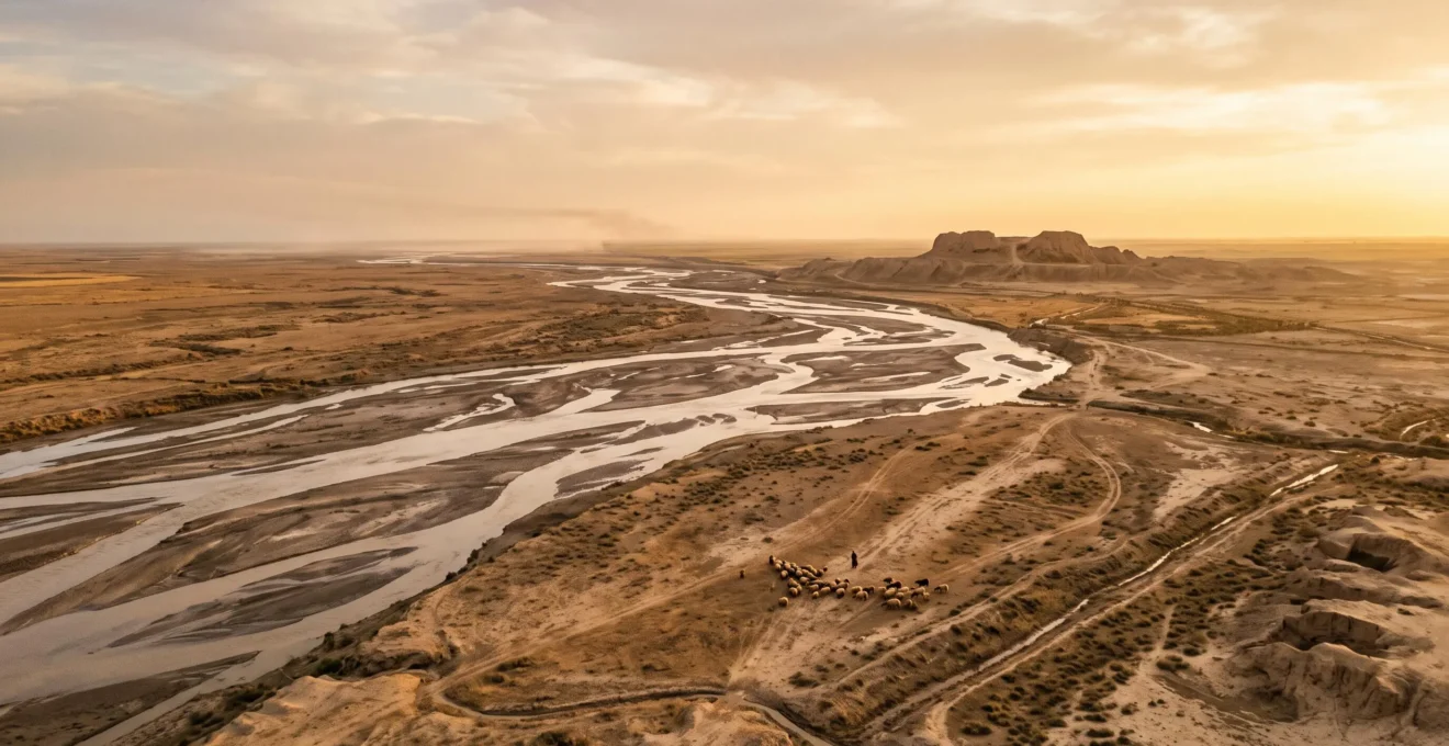
The world’s first cities were not a natural evolution of farming, but a high-risk social gamble in a uniquely challenging environment.
- Mesopotamia’s unpredictable rivers forced a level of social cooperation and technological innovation unseen elsewhere, creating immense agricultural surplus.
- This very success, however, led to long-term environmental collapse and rigid social hierarchies, a pattern that would define urbanism for millennia.
Recommendation: To understand urban origins, look beyond technology and analyze the socio-environmental trade-offs that communities were forced to make.
For centuries, the standard answer to why cities first appeared in Mesopotamia has been deceptively simple: the Fertile Crescent. The lands between the Tigris and Euphrates rivers were uniquely suited for agriculture, which created a food surplus, allowing nomadic hunter-gatherers to settle down and, eventually, build cities like Uruk, Ur, and Babylon. This narrative presents a clean, linear progression from farm to metropolis. But this tidy explanation raises more questions than it answers. Why not the Nile Valley, with its far more predictable and gentle floods? Why not the Indus Valley? What was so special about this specific, volatile piece of land?
The truth is far more complex and compelling. The emergence of urban life was not an inevitable march of progress. It was a precarious, high-stakes negotiation between human ingenuity and a uniquely challenging environment. The very factors that made Mesopotamian agriculture so productive also contained the seeds of its own destruction. The solutions that early communities devised to manage risk—large-scale irrigation, centralized grain storage, and specialized labor—fundamentally rewired human society. They created not only surplus, but also social stratification, political power, and large-scale ecological consequences.
This article deconstructs the old myth. We will explore the specific environmental triggers, social pressures, and population thresholds that converged only in Mesopotamia. By examining the first principles of settlement, we will see that the decision to build a city was a gamble—a radical departure from 100,000 years of mobile existence, driven as much by shared belief and social necessity as by the promise of a full granary. We will analyze how their greatest technological achievement became their greatest long-term liability and how different paths of urban development were possible, offering lessons we are still grappling with in our own cities today.
This exploration will follow the threads of evidence, from environmental data to archaeological finds, to reconstruct the complex process that turned scattered nomadic bands into the world’s first urban citizens. The following sections break down the key questions and turning points in this foundational human story.
Summary: Why Did the First Cities Arise in Mesopotamia, and Not Elsewhere?
- How Did Two Rivers Create the Agricultural Surplus That Built the First Cities?
- Why Did River Irrigation Produce 400% More Grain Than Rain-Fed Fields?
- Why Did 7 Environmental Factors Converge Only in Mesopotamia 6,000 Years Ago?
- How Did Nomadic Groups Decide to Settle Permanently After 100,000 Years of Mobility?
- When Did Communities Abandon Extensive Farming: The 3 Population Thresholds That Forced Change?
- Mesopotamia or Indus Valley: Which Early Civilization Achieved Greater Social Equality?
- The Irrigation Expansion That Made 40% of Farmland Barren in 200 Years
- How Did Medinas Accommodate 100,000 People in 1 Square Mile Without Cars?
How Did Two Rivers Create the Agricultural Surplus That Built the First Cities?
The story of Mesopotamia is fundamentally the story of two rivers: the Euphrates and the Tigris. Yet, unlike the predictable, life-giving annual flood of the Nile in Egypt, these rivers were volatile and often destructive. The Tigris, in particular, was prone to violent, unpredictable flash floods that could wipe out settlements. So why did civilization take root here? The answer lies not in the ease of the environment, but in its specific challenges and opportunities. The rivers carried an immense load of silt from the Anatolian highlands, depositing a layer of incredibly fertile soil on the alluvial plains each year. This was a constant renewal of nutrients that rain-fed lands could never match.
This geography created a unique “socio-environmental convergence.” The surrounding lands were arid, meaning farming was impossible without drawing water from the rivers. This necessity forced communities to innovate. To harness the rivers’ potential, they had to develop cooperative strategies and technologies to manage water. Early farmers learned that the Euphrates, being slower and less prone to catastrophic floods, was the more reliable partner for irrigation. The challenge of the rivers was immense, but the reward—access to perpetually renewed, nutrient-rich soil—was the foundational element that made agricultural surplus possible on a scale never before seen. As historians note, by the 4th millennium BCE, these two parallel rivers had created the perfect, albeit challenging, laboratory for intensive agriculture. This wasn’t a gentle cradle of civilization; it was a crucible where environmental pressure forged social and technological change.
Why Did River Irrigation Produce 400% More Grain Than Rain-Fed Fields?
The leap from subsistence farming to a surplus large enough to support non-agricultural specialists—priests, soldiers, kings—was not incremental; it was exponential. The engine of this explosion in productivity was river irrigation. While the term “400% more grain” is a modern simplification, the underlying principle is correct: the return on investment for irrigated agriculture in Mesopotamia was astronomically higher than for rain-fed farming. There were two primary reasons for this: nutrient delivery and water security. Each flood deposited a fresh layer of mineral-rich silt, a natural fertilizer that rain-fed fields, which are quickly depleted of nutrients, could not replicate. This meant yields didn’t just stabilize; they grew.
More importantly, irrigation decoupled farming from the whims of rainfall. In a controlled canal system, water could be delivered to crops precisely when needed, especially during the critical growing seasons. This dramatically reduced the risk of crop failure due to drought. The investment of labor to dig and maintain canals was immense, but the payoff was a harvest that was not only larger but far more reliable. This reliability was the key. It allowed for long-term planning, the storage of grain, and the creation of a collective food security that could buffer the community against a bad year. It was this predictable surplus, born from the managed chaos of the rivers, that provided the economic foundation upon which the world’s first cities were built.
The scale of this advantage is hard to overstate. This table, based on historical records and archaeological analysis, illustrates the dramatic difference in yields between farming methods.
| Farming Type | Typical Yield Outcome |
|---|---|
| Rain-fed farming (baseline) | Lower, highly variable yields dependent on unpredictable rainfall |
| Early canal irrigation (~6000 BCE) | Roughly 50% higher yields than rain-fed fields |
| Good year, wider Fertile Crescent | Up to 100 times the seed planted |
| Exceptional years under Nebuchadnezzar | 200 to 300 times the seed planted |
Why Did 7 Environmental Factors Converge Only in Mesopotamia 6,000 Years Ago?
While fertile soil and water were essential, they were not sufficient. Many regions had them. The birth of cities in southern Mesopotamia was the result of a unique and unrepeated convergence of at least seven key environmental and geographic factors that created a “perfect storm” of pressure and opportunity.
- Dual River System: The contrasting natures of the fast, flood-prone Tigris and the slower, more manageable Euphrates provided a complex water management challenge that required sophisticated, large-scale cooperation.
- Arid Climate with Alluvial Plains: Unlike regions where rain-fed agriculture was an option, southern Mesopotamia’s aridity made irrigation a necessity, not a choice, forcing the issue of water control.
- Resource Poverty: The alluvial plains famously lacked stone, timber, and metals. This scarcity forced nascent cities to develop long-distance trade networks, stimulating economic complexity and intercultural contact.
- Geographic Openness: With few natural barriers, the plains were open to migration and invasion, creating a constant need for organized defense and the development of political entities capable of mustering an army.
- The “Engine of Surplus”: The combination of sun, water, and endlessly renewed silt created the potential for agricultural yields far exceeding subsistence needs, providing the fuel for specialization.
- Predictable Unpredictability: As one expert source puts it, “Unlike the Egyptians, who could rely on the seasonal flooding of the Nile and irrigate accordingly, the Mesopotamians dealt with rivers that were more unpredictable.” This constant, low-level risk required the creation of centralized storage (granaries) and administrative authorities (temples, palaces) to manage surplus as a buffer.
- Navigable Waterways: The rivers and the vast network of canals served as the region’s first highways, allowing for the cheap and efficient transport of bulk goods like grain, which is essential for feeding a dense urban population.
It was the interplay of these seven factors—not any single one—that created the unique crucible in which urban civilization was forged. The environment did not simply permit cities; it compelled the social structures that define them.
How Did Nomadic Groups Decide to Settle Permanently After 100,000 Years of Mobility?
The traditional model of “agriculture leads to settlement” has been fundamentally challenged by archaeological discoveries, most notably at a site in modern-day Turkey called Göbekli Tepe. This site turns the old narrative on its head. Long before the invention of agriculture or permanent villages, nomadic hunter-gatherers came together to build a monumental ritual complex of massive, intricately carved stone pillars. The effort required suggests a high degree of social organization and a powerful shared belief system. This was not a home; it was a destination, a sacred place that drew people together from across the region.
This has led archaeologists to propose a radical new sequence for the birth of civilization. As the late lead excavator of Göbekli Tepe, Klaus Schmidt, famously argued, the evidence suggests a “ritual → gathering → settlement → agriculture” pathway. The desire to congregate for shared ritual and social purposes came first. These large-scale gatherings, likely involving communal feasts to attract and reward workers, created a powerful social gravity. Over time, it became more practical to live closer to these central places than to travel to them. This was the “Sedentism Gamble”: groups chose to abandon a mobile lifestyle that had been successful for millennia, not for purely economic reasons, but for social and spiritual ones. Agriculture may have then developed as a way to feed the now-stationary, larger population concentrated around these new social hubs. The decision to settle wasn’t a logical response to a food surplus; it was a profound social transformation driven by the human need for community and shared meaning.
Schmidt proposed a radical inversion of the sequence: ritual → gathering → settlement → agriculture.
– Klaus Schmidt (via Göbekli Tepe research synthesis), Why Göbekli Tepe Changed Everything About Prehistory
When Did Communities Abandon Extensive Farming: The 3 Population Thresholds That Forced Change?
The transition from a small village to a bustling city is not a smooth, linear process. It is marked by critical tipping points, or “social complexity thresholds,” where the sheer number and density of people force a fundamental reorganization of society. The informal rules and kinship-based cooperation that work in a community of a few hundred people simply break down when the population swells into the thousands. Archaeologists and historians have identified three key thresholds that likely forced the abandonment of simple, extensive farming in favor of the complex, intensive systems required by urban life.
- The Anonymity Threshold (~150-200 people): Known as Dunbar’s number, this is the rough limit on the number of people with whom one can maintain stable social relationships. Beyond this point, communities can no longer rely on personal ties for social control. Formal rules and designated leaders become necessary to resolve disputes and coordinate action.
- The Specialization Threshold (~1,500-2,000 people): At this scale, the food surplus generated by intensive agriculture becomes large and reliable enough to support a significant number of full-time non-farmers: potters, weavers, priests, and soldiers. This division of labor increases economic efficiency but also creates interdependencies and the potential for social stratification.
- The Urban Process Threshold (~5,000+ people): As historian Peter Turchin notes, “It’s hard to imagine a settlement of 5000 persisting for millennia without urban processes in places.” At this density, a settlement requires true urban infrastructure: centralized administration to manage resources like water and grain, a codified legal system to handle disputes between strangers, public works to maintain canals and walls, and organized defense. It is at this stage that a large village truly becomes a city.
Each threshold represents a point of no return. As communities grew and crossed these lines, they were forced to invent new social technologies—governance, law, religion, bureaucracy—to manage the increased complexity. The city, in this sense, is not just a collection of buildings, but a set of solutions to the problems created by its own density.
Mesopotamia or Indus Valley: Which Early Civilization Achieved Greater Social Equality?
The immense surplus and dense populations of Mesopotamian cities led to a clear and dramatic outcome: steep social hierarchy. Monumental palaces for kings and ziggurats for gods dominated the urban landscape, while vast resources were poured into the lavish tombs of the elite. This model of a ruling class concentrating wealth and power became so common that it was long assumed to be an inevitable consequence of urbanism. However, the ruins of another great Bronze Age civilization, the Indus Valley (or Harappan) civilization, tell a different story.
After a century of excavation at major cities like Mohenjo-daro and Harappa, archaeologists have been baffled by the absence of the typical hallmarks of a ruling class. As the early excavator Sir John Marshall observed, unlike in Mesopotamia, there are no identifiable palaces, no grand royal tombs, and no monumental temples dedicated to specific gods or kings. Instead, there is evidence of remarkable standardization and a focus on public infrastructure. Cities featured sophisticated, city-wide water and drainage systems, standardized brick sizes, and residential districts that show far less variation in wealth than their Mesopotamian counterparts. A study in the journal *Antiquity* even suggests that at the cosmopolitan center of Mohenjo-daro, inequality may have actually declined over the city’s lifespan, indicating a cooperative system focused on ensuring a decent standard of living for all citizens, rather than a system designed to funnel resources to the top.
The following table starkly contrasts these two different expressions of urban power, suggesting that the path of extreme hierarchy taken in Mesopotamia was a choice, not an inevitability.
| Criterion | Mesopotamia | Indus Valley (Mohenjo-daro/Harappa) |
|---|---|---|
| Monumental architecture | Ziggurats and royal palaces dedicated to gods and kings | No confirmed palaces or temples identified to date |
| Elite burials | Richly furnished royal tombs (e.g., Ur) | No royal tombs or elite burial complexes found |
| Public infrastructure | Variable, often centered on temple complexes | Standardized bricks, citywide drainage and wells |
| Evidence of a ruling class | Clear textual and archaeological evidence | No clear evidence after a century of excavation |
| Trajectory of inequality | Increasingly stratified over time | Inequality reportedly declined over the city’s lifespan |
Archaeologist’s Checklist for Assessing Social Equality in an Ancient Site
- Residential Structures: Systematically map and measure all dwellings. Is there a high variance in size and material quality (indicating hierarchy) or relative uniformity?
- Burial Goods Analysis: Inventory grave goods from all excavated burials. Are wealth and status symbols concentrated in a few elite tombs, or distributed more broadly?
- Access to Public Works: Plot the distribution of amenities like wells, drains, and paved streets. Do they serve the entire settlement or only specific elite areas?
- Monumental Architecture: Analyze the function of the largest structures. Are they palaces and temples for a ruling class, or communal facilities like granaries and public baths?
- Craft Specialization Evidence: Examine workshops and tools. Is production controlled and standardized from a central authority, or is it decentralized in household-based industries?
The Irrigation Expansion That Made 40% of Farmland Barren in 200 Years
The irrigation system that was Mesopotamia’s greatest strength was also its fatal flaw. It was an engine of surplus, but it was also an engine of collapse. The process, known as salinization, is a slow and insidious one. The river water used for irrigation contains small amounts of dissolved salts. In an arid climate with high evaporation rates, as the water evaporates from the fields, it leaves the salt behind. Year after year, century after century, these salt deposits accumulate in the topsoil. At first, the effect is negligible. Then, yields begin to decline. Eventually, the salt concentration becomes so high that the land becomes toxic to most crops, turning fertile fields into barren, salt-crusted wasteland.
Ancient cuneiform texts provide a dramatic record of Mesopotamian farmers grappling with this very crisis. As salinization worsened around the end of the Sumerian era (c. 2100 BCE), scribes recorded a drastic shift in agricultural strategy: farmers abandoned the cultivation of less salt-tolerant wheat in favor of hardier barley. It was a brilliant short-term adaptation, but it was also a clear sign that the ecological foundation of their society was cracking. They were winning the battle but losing the war against salt. The long-term consequences have been devastating and enduring. In modern-day Iraq, the heartland of ancient Mesopotamia, it is estimated that over 70% of irrigated land is affected by salinity, with much of it abandoned and the rest suffering yield declines of 30-60%. The ghost of Sumerian agriculture haunts the region to this day, a stark reminder that even the most powerful civilizations can be undone by the unintended consequences of their own success.
Key Takeaways
- The drive for social and ritual gathering was a primary motivator for settlement, potentially preceding the development of agriculture.
- The massive productivity of Mesopotamian irrigation was a double-edged sword, creating both the surplus for cities and the long-term ecological crisis of salinization.
- The extreme social hierarchy seen in Mesopotamia was not an inevitable outcome of urbanism, as the more egalitarian model of the Indus Valley civilization demonstrates.
How Did Medinas Accommodate 100,000 People in 1 Square Mile Without Cars?
While the North African medina is a later urban form, its design principles offer a fascinating window into the timeless challenges of high-density living, challenges first faced in ancient Mesopotamian cities like Uruk. How do you manage tens of thousands of people in a small, walkable area without modern technology? The answer lies in a sophisticated, human-scaled design language that evolved over millennia. Medinas, like their ancient predecessors, are masterpieces of pedestrian-oriented, climate-responsive urbanism.
The core principle is the creation of a hierarchy of space, from public to private. A labyrinth of narrow, winding alleyways, often no wider than a loaded donkey, serves several purposes. They create a natural cooling system, with tall buildings shading the passages from the harsh sun. Their disorienting layout was also a defensive measure, confusing potential invaders. These public arteries feed into semi-private cul-de-sacs, which in turn lead to the private inner courtyards of individual homes. The courtyard house is the fundamental building block, an inward-looking oasis that provides light, ventilation, and a secure private space for the family, shielded from the noise and activity of the street. There is no modern zoning; residential, commercial, and craft activities are interwoven, creating a vibrant, mixed-use environment where life unfolds on foot. Social mechanisms, often enforced by neighborhood elders or religious leaders, were just as important as the physical design for managing disputes and maintaining public order in such close quarters. These ancient principles of density—shading, natural ventilation, mixed-use, and a clear public-private gradient—allowed for a sustainable and socially cohesive urban life long before the age of the automobile and air conditioning.
Ultimately, the story of Mesopotamia is the story of humanity’s first, and perhaps greatest, experiment in large-scale living. It reveals that the city is not a static object but a dynamic process, a constant negotiation between social ambition, technological capacity, and environmental limits. The solutions forged in the Fertile Crescent—from codified laws to monumental architecture—set the template for urban life, but so too did its problems of hierarchy and ecological overshoot. Viewing our own modern cities through this long lens, we see the same tensions at play. The Mesopotamian gamble, in many ways, is one we are all still living.