The success of ancient Arabian trade was not a geographic accident, but the result of mastering a sophisticated ‘soft infrastructure’ of logistics, technology, and information that out-competed rivals like Rome.
- Instead of relying on military conquest, Arab networks thrived on flexible alliances and superior knowledge of harsh environments.
- Technological innovations like the camel saddle and the kamal navigational tool were not just aids, but force multipliers that created new economic possibilities.
Recommendation: To understand ancient economies, look beyond physical roads and focus on the intangible systems of knowledge and risk management that truly generate wealth.
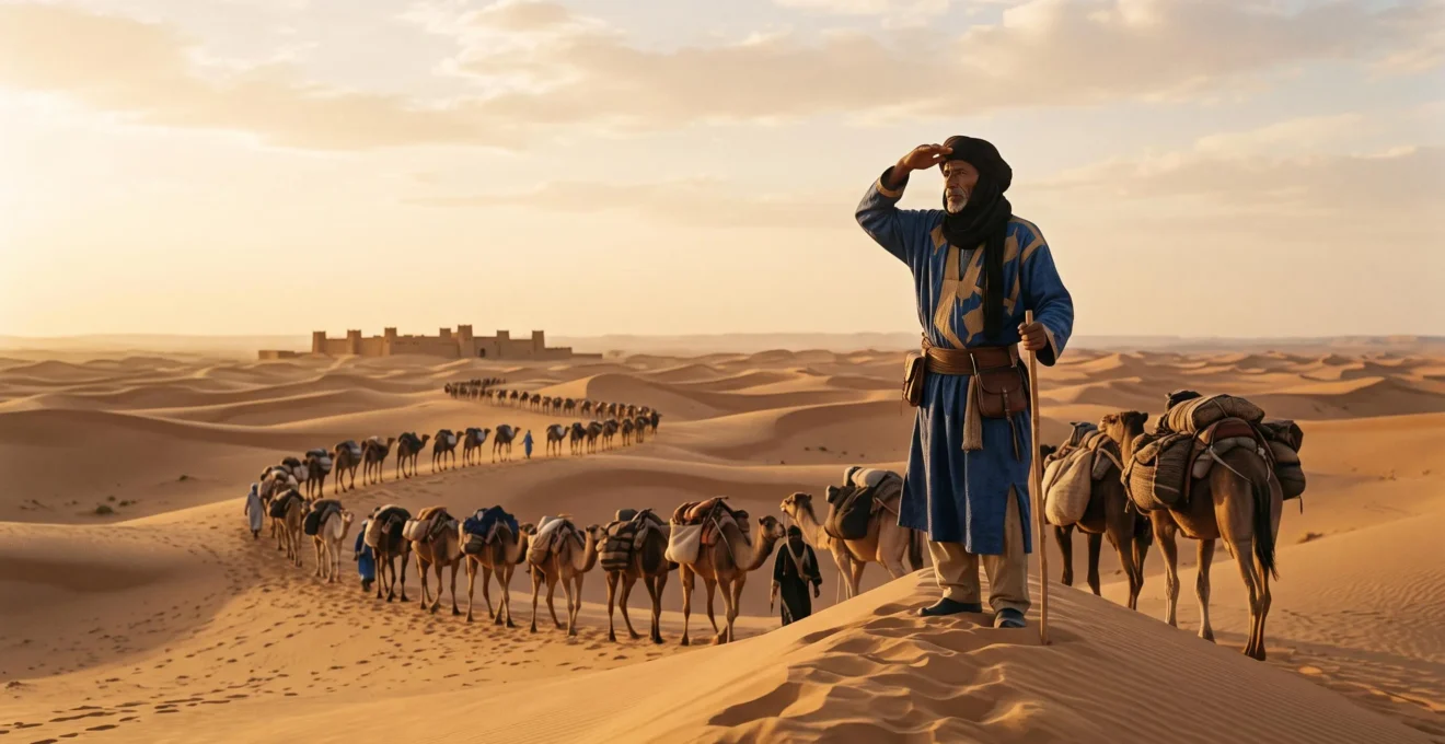
The image of a camel caravan silhouetted against a vast desert sky is an enduring symbol of ancient commerce. For centuries, this vision has been linked to a simple idea: that Arab civilizations grew wealthy merely by being at the geographic crossroads of empires, acting as passive middlemen between East and West. We often hear about the fabled Silk Road, the precious spices, and the exotic goods that flowed through the region. This narrative suggests that their economic power was an accident of location, a tollbooth on the highway of history.
But this perspective misses the real story. It overlooks the genius and innovation that were the true engines of this economic transformation. While the Romans built their empire on the ‘hard infrastructure’ of roads, legions, and aqueducts, the desert kingdoms pioneered a more subtle, yet arguably more resilient, form of power: a ‘soft infrastructure’ built on knowledge, technology, and complex social systems. Their success was not written on maps, but in the stars; not in stone, but in the intricate knots of a navigator’s cord and the design of a camel’s saddle.
What if the key to their dominance wasn’t just controlling territory, but mastering information and mitigating risk in the world’s most challenging environments? This was a world where knowing a camel’s biological limits was more valuable than a legion, and where a small wooden instrument could unlock the riches of an entire ocean. It was a system that could sustain a metropolis in the middle of a waterless desert and project economic influence thousands of miles away.
This article will deconstruct the myth of passive geography. We will explore the specific logistical, technological, and strategic systems that allowed desert merchants to build and sustain global economic power. We will analyze why their flexible networks succeeded where rigid imperial models failed, how they navigated vast expanses without modern tools, and what fatal error could bring the entire system crashing down.
Summary: The Hidden Architecture of Ancient Arabian Economic Power
- Why Did Arabian Trade Networks Succeed Where Roman Routes Failed?
- How Did Merchants Navigate 4,000 Miles of Desert Without Modern Maps?
- Silk Road or Sea Routes: Which Generated More Wealth for Arab Traders?
- The Fatal Error That Destroyed the Wealthiest Trading City in 1258
- When Did Successful Merchants Launch New Routes: The 3 Timing Signals
- Why Does the Silk Road Define Global Trade When Spice Routes Moved More Wealth?
- Why Did Waterless Deserts Become Major Trade Highways for 2,000 Years?
- How Did Precise Navigation Across Desert And Ocean Transform Trade And Discovery?
Why Did Arabian Trade Networks Succeed Where Roman Routes Failed?
The Roman Empire is famed for its “hard infrastructure”—thousands of miles of paved roads, aqueducts, and forts, all secured by the might of its legions. This system was designed for control and extraction. When Rome encountered the wealthy Nabataean Kingdom, a major player in the incense trade, its solution was predictable: conquest. In 106 CE, the kingdom was annexed and turned into the province of Arabia Petraea. Rome’s model was to absorb and administer trade zones directly, imposing its rigid, centralized system. While effective for a time, this approach was expensive, inflexible, and relied on constant military presence.
Arabian trade networks, both before and after the rise of Islam, operated on a fundamentally different principle: flexible, decentralized “soft infrastructure.” Instead of conquest, they relied on a complex web of tribal alliances, kinship ties, and shared commercial contracts. This network was resilient because it wasn’t a single entity that could be decapitated. If one route became dangerous due to political instability, caravans could pivot to another by activating different alliances. This agility allowed them to manage risk far more effectively than a bureaucratic empire.
The success of this model is staggering. It created commercial hubs that dwarfed their European contemporaries. Baghdad, the heart of the Abbasid Caliphate, became a global center for trade, scholarship, and culture. At its peak, it was one of the world’s largest and most important trade hubs, with a population that may have reached around 1,000,000 inhabitants by 1200 CE. This was not the product of paved roads, but of a sophisticated system of trust, information, and adaptability that could move immense wealth across political and geographical boundaries with unparalleled efficiency.
The contrast is clear: Rome used hard power to force trade through its arteries, making the routes dependent on the empire’s health. Arabian networks used soft power to create a circulatory system that could bypass blockages and find new pathways, making the network itself the source of enduring power.
How Did Merchants Navigate 4,000 Miles of Desert Without Modern Maps?
For the modern mind, navigating a featureless desert without GPS seems impossible. Yet for thousands of years, caravans regularly traversed thousands of miles of arid wilderness. Their success rested not on paper maps, but on a deep, multi-generational body of environmental and logistical knowledge—a core component of their “soft infrastructure.” Navigation was a science of observation, memory, and profound understanding of the natural world.
The primary tools were the sun, the stars, and the land itself. Guides, often from Bedouin tribes, were human libraries of navigational data. They could determine direction from the position of the sun and the movement of shadows. At night, they used constellations, particularly the pole star, to maintain a true course. But direction was only half the battle. Survival depended on knowing the landscape intimately: the location of hidden wells, the meaning of subtle changes in sand color, and the unique silhouettes of distant rock formations that served as unmovable landmarks.
This “map” was layered with crucial logistical data, centered on the caravan’s most vital asset: the camel. The entire system was built around the animal’s remarkable biology. Planners knew that camels could travel for weeks and understood the precise knowledge of an animal’s extreme endurance limits, which could extend up to 50 days without water in cooler winter months. Routes were not straight lines, but a series of calculated legs between known water sources, timed to the season and the herd’s condition. This was risk management at its most elemental, turning a deadly environment into a predictable commercial highway through sheer expertise.
This system of navigation was less about finding a path and more about managing a complex, moving ecosystem. It was a form of information arbitrage, where the merchants’ and guides’ superior knowledge of the environment gave them a decisive economic advantage, allowing them to connect markets that others deemed unreachable.
Silk Road or Sea Routes: Which Generated More Wealth for Arab Traders?
The “Silk Road” dominates the popular imagination of ancient trade, evoking images of camel caravans carrying precious Chinese silks to Roman markets. While silk was a valuable luxury good, the focus on this single commodity and overland route is misleading. For many Arab traders, the maritime routes of the Indian Ocean and the Arabian Sea—the “Spice Routes”—were arguably a far greater and more consistent source of wealth. These sea lanes carried bulk goods like spices (pepper, cloves, nutmeg), timber, and grains in quantities that land-based caravans could never match.
The true genius of Arab merchants was not in choosing one route over the other, but in positioning themselves at the critical intersection of both. They controlled the key transshipment points where maritime cargo was offloaded and transferred to overland caravans for distribution into the Mediterranean and the Levant. The port of Aden, at the tip of the Arabian Peninsula, was a prime example of this strategy. Here, goods from India and the Far East, carried on dhows, were consolidated and then sent north by land. This intermediary role allowed Arab traders to capture value by bridging two distinct commercial systems, profiting from both sea and land trade without having to exclusively compete in either.
The wealth generated by controlling these overland nodes was immense. Cities like Petra, a Nabataean stronghold, existed almost entirely as a function of the caravan trade. Located in a seemingly inhospitable desert, it thrived by offering security, water, and market access to passing caravans. Archaeological evidence suggests that in its heyday, a desert city could sustain tens of thousands of residents purely on trade revenue, with estimates ranging from 30,000 to 40,000 inhabitants. This demonstrates that control over a critical segment of a trade route could be just as lucrative as controlling the source of the goods themselves. The real profit was in the logistics, not just the product.
Ultimately, the debate of sea versus land is a false dichotomy. Arabian economic power came from mastering the synergy between them, creating a unified network that was more than the sum of its parts.
The Fatal Error That Destroyed the Wealthiest Trading City in 1258
For centuries, Baghdad was the glittering center of the Islamic world’s commercial and intellectual power. It was the heart of the Abbasid Caliphate and the terminus of countless trade routes. Its wealth was legendary, but it was also fragile, resting upon a sophisticated infrastructure—both “hard” and “soft”—that had been developed over generations. The fatal error of its last Caliph, Al-Musta’sim, was a catastrophic failure to recognize a new kind of existential threat: the Mongols.
When the Mongol forces led by Hulagu Khan arrived at the gates of Baghdad in 1258, the Caliph grossly underestimated their intent and capabilities. He responded with diplomatic arrogance and military unpreparedness, believing his city’s prestige and defenses were impregnable. This was a fatal miscalculation. The Mongols were not a rival regional power to be negotiated with; they were a global force operating on a different scale of warfare and conquest. The siege was short and brutal. The city’s defenses were overwhelmed, and what followed was one of the greatest acts of cultural and economic destruction in history, with the staggering casualty estimates from contemporary chronicles ranging from 200,000 to over a million killed.
But the true destruction went far beyond the loss of life and looted treasures. The Mongols systematically dismantled the very infrastructure that made the city viable. The great libraries, including the House of Wisdom, were destroyed, erasing centuries of accumulated knowledge—the city’s “soft infrastructure.” Even more critically, they targeted the physical lifeblood of the region’s agriculture and commerce. As historian Steven Dutch noted, this act of destruction had permanent consequences:
The Mongols filled in the irrigation canals and left Iraq too depopulated to restore them.
– Steven Dutch, Battle of Baghdad (1258) — Islam Wiki
This was the fatal blow. By destroying the vast canal network that irrigated the fertile plains around the city, the Mongols turned a thriving agricultural heartland into a swampy, disease-ridden wasteland. They didn’t just conquer a city; they erased the economic and ecological foundation it was built on. The great trading hub of Baghdad never fully recovered, a stark lesson that the most sophisticated commercial network is only as strong as the physical and intellectual infrastructure that supports it.
When Did Successful Merchants Launch New Routes: The 3 Timing Signals
In the high-stakes world of ancient trade, launching a new route was a massive gamble. A successful venture could generate a fortune, but a failure could mean financial ruin and death in the wilderness. Successful merchants were not reckless adventurers; they were astute strategists who knew how to read the signals indicating that the time was right to innovate. Three key signals consistently prompted the creation of new, more ambitious trade routes.
The first signal was political stabilization. The establishment of a large, stable empire, like the early Islamic Caliphates or the Pax Mongolica, dramatically reduced the risk of banditry and arbitrary tolls. When a single power controlled vast territories, it created a secure corridor for commerce. Merchants were quick to exploit these windows of peace to establish longer, more direct routes that were previously too dangerous to attempt. Safety was the prerequisite for scale.
The second signal was technological breakthrough. An innovation that increased efficiency or opened up new possibilities could completely redraw the commercial map. A prime example is the development of the North Arabian camel saddle around the 5th century BCE. This new design distributed the load over the camel’s hump more effectively, allowing for a much heavier cargo. With an improved saddle design that dramatically increased cargo capacity to around 400 pounds per animal, the cost-effectiveness of long-distance land trade soared. This single piece of technology made trans-Saharan trade viable on a massive scale, opening up the wealth of West Africa to the Mediterranean world.
The third signal was market saturation or disruption. When an existing route became too crowded, profits would shrink due to competition. Likewise, if a traditional route was cut off by war or political change (like the fall of a key city), merchants were forced to find alternatives. This market pressure spurred innovation, pushing traders to explore uncharted deserts and seas to find a new competitive edge or simply to survive. These moments of crisis were often the birthplaces of the next great trade routes.
Auditing a Historic Trade Route’s Viability: A 5-Point Checklist
- Political Stability: Identify the ruling powers along the entire route. Are there unified empires or fragmented, warring factions? A single, stable authority is a key asset.
- Logistical Nodes: Inventory all oases, wells, and caravanserais. Are they secure and adequately spaced for the endurance limits of your camels or ships?
- Technological Edge: Assess your transport technology (saddle design, ship type, navigational tools). Does it offer a quantifiable efficiency gain over competitors?
- Security Costs: Calculate the expense of protection. How many guards are needed? What “tolls” or tribute must be paid to local tribes or rulers?
- Market Demand: Confirm the value of your goods at the destination. Is the demand high enough to justify the risks and costs of the journey?
Why Does the Silk Road Define Global Trade When Spice Routes Moved More Wealth?
Ask anyone to name an ancient trade route, and the answer will almost certainly be “the Silk Road.” The term has become a powerful brand, synonymous with exotic adventure and the dawn of globalization. Yet, as many historians argue, this romantic narrative obscures a more complex economic reality. In terms of sheer volume and value, the maritime spice routes of the Indian Ocean, largely dominated by Arab, Indian, and Persian sailors, likely moved far more wealth than the overland caravans carrying silk.
The dominance of the “Silk Road” in our collective memory is not an accident of history, but a product of its modern invention. The term itself—*Seidenstrasse* in German—was coined not in antiquity, but in 1877 by the German geographer and historian Ferdinand von Richthofen. His goal was not just to describe an ancient network, but to create a compelling narrative that served contemporary interests. As scholarship on the topic reveals, Richthofen’s concept was deeply intertwined with 19th-century German geopolitical ambitions for a railway connecting Europe to China, following the path of his “ancient” Silk Road. The name provided a historical precedent and a romantic justification for a modern industrial project.
The term was a brilliant piece of branding. “Silk” is a far more evocative and luxurious word than “pepper” or “cloves.” The image of the camel caravan crossing epic landscapes is more romantic than a dhow navigating the open sea. The narrative took hold, amplified by explorers, archaeologists, and writers throughout the 20th century. It provided a simple, linear story for a complex, multi-faceted network of trade that was never a single “road” at all.
The result is that the Silk Road’s fame is more a triumph of naming and narrative than a precise reflection of its relative economic importance. It has become, as one scholar notes, a term so powerful that its modern origins must be constantly pointed out. While undeniably important, its story often overshadows the equally, if not more, significant maritime trade that formed the true backbone of intercontinental commerce for centuries.
Why Did Waterless Deserts Become Major Trade Highways for 2,000 Years?
At first glance, the desert seems like the ultimate barrier to commerce—a vast, hostile environment devoid of the most essential resource: water. Yet, for millennia, the great deserts of Arabia and the Sahara were not obstacles but conduits, transformed into bustling commercial highways. This remarkable feat was achieved through a combination of brilliant engineering, specialized technology, and an intimate understanding of the desert ecosystem.
The first key was the ability to create oases where nature provided none. The Nabataeans, masters of the incense trade, were unparalleled hydraulic engineers. In their capital city of Petra, carved from sheer rock, they built a sophisticated system of dams, cisterns, and channels to capture and store precious rainwater. This network was so effective it created a man-made oasis, providing enough water to support a thriving metropolis and the thousands of traders and camels passing through. The system was capable of supplying an estimated 1,800 cubic meters of water per day, a staggering feat of engineering that effectively “solved” the desert’s water problem at a critical logistical node.
The second key was the mastery of the “ship of the desert,” the camel, through technological innovation. The invention of the North Arabian saddle was a revolutionary development. As summarized by the work of historian Richard Bulliet, this technology was what truly “allowed the camel nomads to take control of the caravan routes.” It enabled them to not only carry significant cargo but also to weaponize the camel for warfare, giving them the power to protect caravans and control territory. The saddle was the interface between man, animal, and commerce, a piece of handcrafted, tactile technology that made the entire system of long-distance desert trade physically possible.
Deserts became highways because human ingenuity made them predictable. By engineering water supplies at strategic points and perfecting the technology to efficiently use the only animal suited for the environment, merchants and desert-dwellers transformed these “waterless” expanses. They laid down an infrastructure not of roads, but of knowledge, water, and technological mastery.
Key takeaways
- Economic power in the ancient world was not just about resources, but about the systems created to move them.
- Arabian success relied on ‘soft infrastructure’—adaptable networks of alliances, information, and trust—which often proved more resilient than the ‘hard infrastructure’ of empires.
- Technological innovations, from navigational tools to the camel saddle, were not minor improvements but catalysts that unlocked entirely new trade routes and economic possibilities.
How Did Precise Navigation Across Desert And Ocean Transform Trade And Discovery?
The expansion of trade from regional to global scale depended on one crucial factor: the ability to navigate accurately and repeatedly over vast, featureless expanses of desert and ocean. The transition from secretive, memorized knowledge to a system of scientific, tool-based navigation was a revolution that transformed commerce and discovery. Arab sailors and scholars of the Islamic Golden Age were at the forefront of this transformation, inventing and synthesizing tools that made long-distance travel a predictable science.
One of the most significant innovations was the kamal. Invented by Arab navigators in the late 9th century, this brilliantly simple device consisted of a small rectangular wooden card attached to a knotted string. By holding the string in their teeth and adjusting the card’s position until its top and bottom edges aligned with the horizon and a specific star (usually Polaris), a navigator could determine their latitude with remarkable accuracy. This was not guesswork; it was applied trigonometry. With practice, the kamal allowed for a simple wooden instrument capable of remarkable navigational precision, achieving an accuracy of within half a degree.
This tool was revolutionary. It freed sailors from the necessity of hugging coastlines, allowing them to strike out across the open Indian Ocean with confidence, knowing they could find their east-west destination by simply sailing north or south until they reached the correct latitude. The kamal was a key part of an integrated navigational toolkit. Arab sailors combined it with other instruments, such as the astrolabe for more complex calculations and the magnetic compass (adapted from Chinese origins), creating a sophisticated system for ‘latitude sailing’.
This shift from reliance on personal memory to a system of shareable, scientific tools had a profound economic impact. It democratized navigational knowledge, reduced the risk of getting lost, shortened journey times, and opened up new, more direct sea lanes. By making navigation more of a science and less of a secret art, these tools transformed the unpredictable ocean into a reliable highway, laying the technical foundation for an interconnected global economy centuries before the European Age of Discovery.
By mastering the soft infrastructure of logistics, information, and technology, these ancient kingdoms did not just participate in global trade; they architected it. Their legacy is a powerful reminder that true economic power often flows not along paved roads, but through the invisible networks of human ingenuity. To truly understand the foundations of our modern interconnected world, the next step is to apply these historical lessons to contemporary global supply chains.