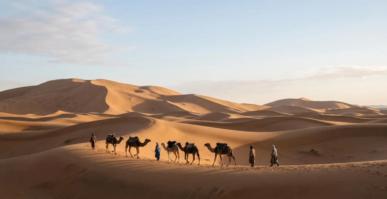
Far from being a desolate wasteland, the desert was a complex system that fostered one of humanity’s most sophisticated forms of environmental intelligence.
- Survival depended not on brute force, but on a deep “literacy” in reading stars, sand, and stone to navigate and find water.
- Thriving required advanced social engineering—intricate water-sharing laws and economic networks—that turned oases into prosperous cities.
Recommendation: To understand human resilience, we must look to these desert cultures who treated the environment not as an obstacle to conquer, but as a system to master.
The popular imagination paints deserts as barren voids—vast, inhospitable expanses of sand and rock, fundamentally hostile to life. For environmental anthropologists and historians, however, this perception masks a profound truth. The great deserts of the Arab world and the Sahara were not empty stages, but crucibles that forged some of the most resilient and ingenious cultures on Earth. The challenge of survival was so immense that it demanded more than simple endurance; it required a complete fusion of environmental science, social organization, and cultural memory.
Conventional wisdom focuses on the camel as the “ship of the desert” or the simple fact that nomads followed the stars. But these are merely symptoms of a much deeper phenomenon. The real story lies in the “why” and the “how.” Why did these arid lands, seemingly defined by their lack of water, become the arteries for global trade for millennia? How did societies develop a form of cartography based on landmarks that literally vanished with the wind? The key was the development of a unique and holistic “desert literacy”—an integrated knowledge system where astronomy, geology, hydrology, and social contracts were not separate disciplines, but interwoven threads of a single survival framework.
This deep understanding transformed a deadly environment into a manageable, and even predictable, system. It allowed for the creation of wealth, the founding of cities, and the persistence of cultures against the constant pressure of both nature and external invaders. This article explores the core components of that ingenuity. We will deconstruct the methods of Bedouin navigation, compare the water conservation strategies of different desert peoples, and analyze how the very geology of the dunes shaped both physical geography and cultural identity, ultimately revealing a masterclass in human adaptation.
Summary: How Desert Cultures Mastered an Unforgiving World
- Why Did Waterless Deserts Become Major Trade Highways for 2,000 Years?
- How Did Bedouin Navigate 1,000 Miles of Featureless Sand Without Compasses?
- Arabian or Saharan Desert Cultures: Which Developed Superior Water Conservation Methods?
- The Route Miscalculation That Killed 300 Merchants in 4 Days
- When Did Expert Caravans Depart: The 4 Seasonal Windows for Safe Desert Crossing?
- Mountain Amazigh or Desert Bedouin: Which Culture Better Withstood External Conquest?
- Why Did Desert Guides Memorize 500 Landmarks That Disappeared Every Decade?
- How Do Desert Dunes Shape Both Physical Geography and Cultural Identity?
Why Did Waterless Deserts Become Major Trade Highways for 2,000 Years?
The existence of thriving trade routes through hyper-arid deserts presents a striking paradox. The answer lies not in overcoming the desert, but in mastering its logic for immense economic gain. The primary motivation was the insatiable demand for luxury goods that originated in or had to cross these territories. Frankincense and myrrh, resins more valuable than gold, were the lifeblood of this economy. To control their flow was to control immense wealth, a fact that turned desolate landscapes into strategic assets. Indeed, the ancient Incense Route stretched some 2,000 kilometers from Southern Arabia to the Mediterranean, a testament to the profitability that justified such a perilous journey.
This was not mere opportunism; it was a highly engineered enterprise. Cultures like the Nabateans didn’t just traverse the desert; they terraformed it to serve their economic ambitions. As the UNESCO recognition of the Desert Cities in the Negev shows, their prosperity was built on a foundation of sophisticated urban planning and revolutionary water-collection systems. These weren’t just rest stops; they were fortified cities with cisterns, dams, and reservoirs that allowed them to monopolize trade by being the sole providers of safety and sustenance. They demonstrated that with sufficient ingenuity, oases could be manufactured, turning choke points in the desert into centers of power.
This economic imperative elevated the control of these routes to a primary geopolitical goal. As observed by historian Sterenn Le Maguer-Gillon, this transformed the desert from a natural barrier into a political chessboard.
Controlling the caravan routes used to transport goods such as frankincense and myrrh became a key military and economic objective.
– Sterenn Le Maguer-Gillon, The Incense Trade Route, Wadi Dawkah
The desert highways thrived for 2,000 years because their economic value was so high that it funded the very infrastructure and knowledge systems needed to make them viable, creating a self-sustaining cycle of risk and reward.
How Did Bedouin Navigate 1,000 Miles of Featureless Sand Without Compasses?
Navigating vast, seemingly uniform seas of sand without modern instruments represents a pinnacle of human environmental literacy. For the Bedouin and other desert peoples, the landscape was not featureless at all; it was a text to be read, filled with subtle clues invisible to the untrained eye. This “desert literacy” went far beyond simply following the sun or stars. It involved a multi-sensory understanding of the environment, where the shape of a dune, the texture of sand, and the direction of the wind were all data points in a complex mental map.
A core principle was understanding the physics of the desert itself. Guides knew that the very structure of the dunes was a compass created by the wind. This is a perfect example of applied geology as a navigation tool.
As desert survival expert Sam McConnell explains, this knowledge turns the entire landscape into a directional grid: “Sand dunes form at 90 degrees to the prevailing wind… so if the prevailing wind is from the east, the dunes will run north to south.” A guide could therefore maintain a consistent bearing by keeping the dune ridges at a specific angle to their direction of travel. This was combined with star navigation at night, creating a 24-hour system of positioning that was both resilient and remarkably precise.
This knowledge was not innate; it was a fragile cultural inheritance passed down through generations of apprenticeship. The case of Tuareg guides in the Libyan Sahara provides a stark illustration of this. Field observations revealed that older guides possessed an encyclopedic knowledge of constellations for night travel, a skill largely lost among younger generations who had become reliant on modern technology. This generational gap highlights a crucial point: this sophisticated navigational system was a form of living knowledge, which could erode and vanish within a generation if not actively practiced and transmitted. It was a skill as precious as water, and as easily lost.
Arabian or Saharan Desert Cultures: Which Developed Superior Water Conservation Methods?
The question of “superiority” in water conservation between Arabian and Saharan cultures is best answered by examining their different environmental constraints and the ingenious solutions they produced. It’s not a matter of one being better, but of two different philosophies of adaptation: one based on mastering natural geology, the other on creating artificial hydrology. Each represents a brilliant response to the absolute imperative of securing water.
In the Sahara, cultures like the Tuareg became experts at locating and managing naturally occurring water sources known as *gueltas*. These are not simple puddles, but deep, rock-shielded pools that can hold water for long periods. The genius here was not in construction but in discovery and management. Knowledge of guelta locations was a form of currency, a life-or-death map etched in the minds of guides. These rock pools, found at altitudes between 1,000 and 2,000 metres, are often hidden deep within mountain massifs, making them defensible and protected from the worst of the sun’s evaporation. The Saharan approach was thus one of opportunistic mastery of the existing landscape.
In the more settled regions of the Arabian Peninsula, a different strategy emerged: large-scale social and environmental engineering. The Aflaj Irrigation Systems of Oman, a UNESCO World Heritage site, are a testament to this approach. Instead of relying solely on surface water, Omani communities developed extensive networks of underground channels that tapped into subterranean water tables, carrying water for miles to agricultural settlements. This method of proactive engineering required not only immense labor but also sophisticated social structures. The Aflaj systems necessitated complex, community-agreed laws to govern water-sharing rights, ensuring equitable distribution and long-term sustainability. It was a technological solution that was inseparable from its social framework.
A Researcher’s Checklist for Analyzing Desert Adaptation
- Water Source Analysis: Document the type (well, guelta, aflaj), permanence, and social rules governing access to every identified water source.
- Navigational Method Inventory: Interview guides to distinguish between celestial, geological (dune reading), and landmark-based “oral map” techniques.
- Resource Management Audit: Investigate the formal or informal laws governing the use of grazing lands, firewood, and other scarce resources.
- Material Culture & Technology: Catalog tools, clothing, and shelter designs, noting specific adaptations for heat mitigation, water transport, and mobility.
- Oral History & Knowledge Transmission: Record stories, poems, and proverbs that contain ecological knowledge, and map how this wisdom is passed between generations.
The Route Miscalculation That Killed 300 Merchants in 4 Days
The annals of desert travel are filled with tales of triumph, but they are haunted by the silent tragedies of those who failed. The story, passed down in oral traditions, of a large caravan of 300 merchants perishing in just four days serves as the ultimate cautionary tale about the razor-thin margin between life and death. This was not a story of ambush or disease, but of a single, catastrophic navigational error. It is a stark reminder that in the desert, geography is destiny, and a minor miscalculation has absolute consequences.
The setting for such tragedies was often the *Tanezrouft* or “Land of Thirst”—regions so utterly devoid of features and water that they were considered a void even by seasoned travelers. These are places in zones so arid they were never permanently settled, with summer temperatures regularly soaring above 50°C and virtually no rainfall. To enter the Tanezrouft was to make a pact with time and distance. You carried only the water you needed to reach the next known well. There was no room for error, no possibility of turning back.
In this context, the caravan’s fate becomes terrifyingly clear. A deviation of just a few degrees, a misidentification of a star, or a guide’s momentary lapse in judgment could lead the entire caravan astray. In the featureless expanse, they would not realize their mistake for hours, perhaps a full day. By then, they would be miles off course, their precious water supply calculated for a different endpoint. The first day would bring anxiety; the second, fear; the third, despair; and the fourth, death. The desert doesn’t forgive. It simply enforces the laws of physics and biology. This story, whether literal or allegorical, underscores the absolute authority of the guide and the non-negotiable precision required. It is the dark inverse of the stories of success, proving the rule by its horrific exception.
When Did Expert Caravans Depart: The 4 Seasonal Windows for Safe Desert Crossing?
For expert caravan leaders, the question was never *if* they could cross the desert, but *when*. The timing of a departure was not a matter of convenience but the single most important factor determining the success or failure of the expedition. The desert year was not divided into four equal seasons in the temperate sense, but rather into windows of opportunity and periods of certain death. To ignore this calendar was to court disaster. The entire enterprise of long-distance trade was built upon this deep, almost ritualistic, understanding of environmental timing.
The most significant constraint was heat. In the height of summer, daytime travel was not just uncomfortable; it was lethal. With summer temperatures that can climb as high as 60°C, the air itself becomes a threat, dehydrating man and beast at an astonishing rate. Consequently, summer expeditions were a last resort, undertaken almost exclusively at night. This inverted the world, forcing guides to rely entirely on their knowledge of the stars and creating a surreal, nocturnal rhythm of life and commerce.
The four “windows” for travel were defined by a careful balance of risks:
- Autumn (September-November): Often considered the premium window. The punishing heat of summer has broken, water sources may have been partially replenished by late-season storms, and temperatures are moderate for both day and night travel.
- Winter (December-February): A viable but riskier window. Temperatures can drop below freezing at night, requiring different gear and posing a risk of hypothermia. The primary danger, however, is the chance of rare but violent winter rains causing flash floods in wadis and canyons.
- Spring (March-May): The second premium window. Similar to autumn, with pleasant temperatures and the added benefit of blooming vegetation in some areas, providing extra fodder for camels. The risk of sandstorms (*khamsin*) begins to increase towards the end of this period.
- Summer (June-August): The window of last resort. Only the most experienced guides on the most critical missions would attempt major crossings, and then only by adhering to a strict nocturnal travel schedule. The risk of heatstroke and rapid dehydration was at its absolute maximum.
Each window demanded a different set of preparations, a different route, and a different mindset. This seasonal calculation was the first and most critical layer of the “calculated risk” that defined desert life.
Mountain Amazigh or Desert Bedouin: Which Culture Better Withstood External Conquest?
When examining resistance to external powers like the Roman, Byzantine, or later colonial empires, both the Amazigh of the Atlas Mountains and the Bedouin of the Arabian deserts demonstrated remarkable resilience. However, they achieved this through two distinct strategies, each dictated by their unique environment. The question isn’t which was “better,” but how their specific geographies fostered different, yet equally effective, models of withstanding conquest.
The Amazigh model was one of fortress-based resistance. Their power lay in the verticality and inaccessibility of their mountain homelands. The rugged terrain of the Atlas or Rif mountains created natural fortifications. Invading armies, with their cumbersome supply lines and conventional tactics, found it nearly impossible to project power into these isolated valleys and high plateaus. The Amazigh could engage in guerrilla warfare, melting back into a landscape they knew intimately, turning every cliff and pass into a potential ambush point. Their resilience was static and defensive, rooted in a specific, defensible territory. They held their ground because their ground was a weapon.
The Bedouin model, in contrast, was one of fluid, mobile resistance. Their power lay in the vastness and emptiness of the desert. The desert itself was their fortress, but it was a fortress without walls. For an invading army, the desert was a logistical nightmare—a huge, waterless void that consumed resources and morale. The Bedouin did not need to defeat an army in a pitched battle; they simply had to outlast it. Their nomadic lifestyle meant they had no cities to sack, no fields to burn. Their society was as mobile as the sands. They could disappear into the immense interior, drawing invaders deep into hostile territory until their supply lines broke and they withered from thirst and exhaustion. Their resilience was dynamic and evasive, rooted in the denial of a fixed target. They survived by refusing to be found.
Ultimately, both cultures successfully leveraged their environments as a strategic asset. The Amazigh used static, defensible geography to create impregnable strongholds, while the Bedouin used vast, indefensible geography to become an uncatchable target. Each demonstrates a profound understanding of how to turn a challenging environment into a powerful ally against a technologically superior foe.
Why Did Desert Guides Memorize 500 Landmarks That Disappeared Every Decade?
The concept of a map in the Western sense—a static, permanent representation of terrain—is profoundly unsuited to the desert. In an environment where sand dunes can shift hundreds of feet in a single season and tracks can be erased by the wind overnight, navigation required a different kind of cartography: one that was dynamic, layered, and stored entirely in human memory. This was the world of “ephemeral cartography,” where guides were living libraries of geographic knowledge.
The landmarks a guide memorized were not just a few prominent mountains. Their mental database contained hundreds, even thousands, of data points. This included not only permanent features like rock outcroppings but also a vast catalog of temporary or subtle markers: a uniquely shaped dune that might only last a decade, a patch of hardy vegetation, the specific texture and color of sand in a particular area, or even the memory of a camel skeleton. As Grokipedia notes on Bedouin culture, this was a highly structured system.
Beduini guides memorized “oral maps” of hills, valleys, and caravan tracks, using landmarks like rock formations and deep sand paths to maintain direction.
– Grokipedia, Bedouin — Grokipedia
The reason for memorizing landmarks that disappear was that the “map” was constantly being updated. A guide’s knowledge wasn’t a single snapshot but a time-lapse video. They knew not only where a dune was now, but where it was five years ago and which way the wind was likely to move it. This four-dimensional thinking allowed them to navigate in a landscape that was in a constant state of flux. They navigated not just space, but time.
The staggering effectiveness of this method was proven time and again. The 1924 journey of Ahmed Hassanein Bey is a prime example. His caravan navigated a 2,200-mile stretch of the Sahara, often traveling at night with no visible landmarks, relying solely on the guide’s knowledge of the stars. This incredible feat of navigation led to the “rediscovery” of the lost oases of Jebel Arkenu and Uweinat, places that were never lost to the desert peoples, only to the outside world. It was definitive proof that these oral maps, passed down through generations, were every bit as accurate and powerful as any printed chart.
Key Takeaways
- Desert survival was not about endurance but about intelligence—a “desert literacy” that read the environment as a complex system.
- Economic incentives, like the frankincense trade, were powerful enough to fund the sophisticated social and logistical engineering required to create desert trade routes.
- Navigation was a four-dimensional skill, combining astronomy with an understanding of how geology and wind shaped a constantly changing landscape.
How Do Desert Dunes Shape Both Physical Geography and Cultural Identity?
The sand dune is the most iconic feature of the desert, but it is far more than a simple geographical formation. It is the physical manifestation of the desert’s most powerful forces—wind, time, and impermanence. As such, the dune profoundly shapes not only the physical landscape but also the cultural and philosophical identity of the people who live within its domain. The dune is both the stage and a primary character in the story of desert life.
Physically, the desert is a landscape in perpetual motion. In the deep Sahara, for example, the terrain is continuously reshaped by wind erosion, a process known as aeolian deflation, with almost no vegetation to hold the sand in place. This constant reshaping means that the very ground beneath one’s feet is not solid or permanent. This geological reality forces a mindset of adaptation over permanence. You cannot build a stone fortress on a moving sea of sand. Instead, you must be as mobile and adaptable as the landscape itself. This directly influenced the development of nomadic cultures, whose lightweight tents and mobile lifestyles are a perfect mirror of the transient environment.
This physical reality bleeds directly into cultural identity. The dune’s ever-changing nature becomes a powerful metaphor for life, fate, and time. In desert poetry and proverbs, the shifting sands often represent the transient nature of human existence and the futility of fighting against greater forces. However, this is not a philosophy of pure fatalism. It is a philosophy of acceptance and alignment. Just as a guide navigates by aligning with the dune ridges, desert culture often emphasizes aligning oneself with the natural and divine flow of events. Furthermore, the underlying geology dictates life itself. The existence of *gueltas*—pockets of water held within solid rock formations beneath the sand—illustrates how the desert’s hidden, permanent geology directly dictates where life is possible. Settlement patterns are thus tied not to the shifting sands, but to the unmoving stone beneath, creating a cultural geography of hidden anchors in a sea of movement.
The dune is therefore a dual symbol. It represents the impermanence and harshness of the desert, while simultaneously holding the promise of a hidden, life-sustaining reality beneath its surface. It teaches a fundamental lesson of the desert: what you see is not all there is, and survival depends on understanding the invisible structures that govern the visible world.
By understanding these intricate systems of adaptation, we gain a profound respect for the resilience of desert cultures. The next step for any scholar or enthusiast is to apply this lens of “desert literacy” to other extreme environments, seeking out the hidden ingenuity that allows life to flourish in the most unlikely of places.