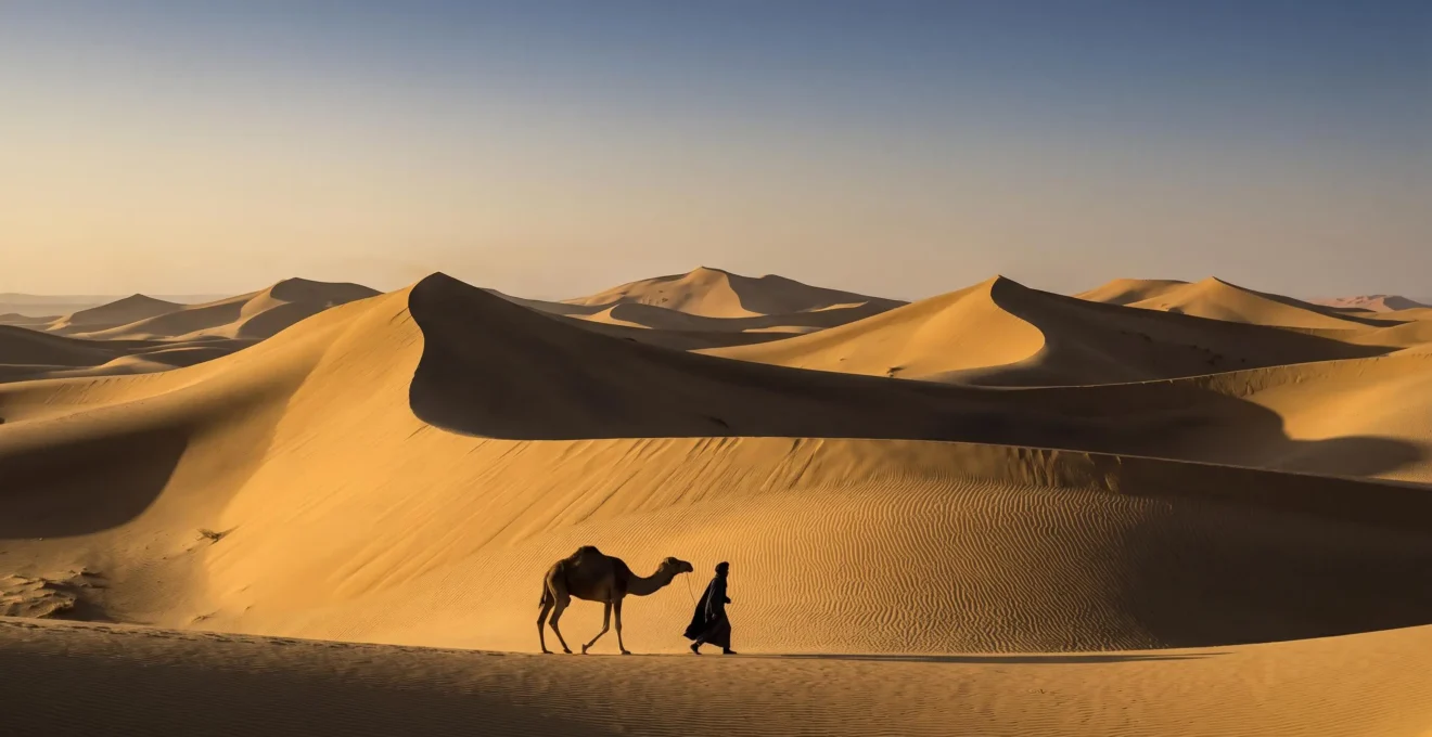
Contrary to the common view of deserts as empty, static voids, this analysis reveals that dune landscapes are a dynamic, readable text. We will explore how desert communities didn’t just survive these environments but thrived by developing a sophisticated cognitive ability to interpret shifting sands, predict their movement, and embed this knowledge into their cultural identity, turning physical geography into a foundation for memory and meaning.
The image of a desert dune is iconic: a vast, silent wave of sand, seemingly eternal and unchanging. This perception fuels a common narrative of the desert as a harsh, featureless expanse, an obstacle course for human survival. For centuries, geographers focused on the mechanics of aeolian processes, while cultural scholars documented the myths and hardships of desert peoples. This approach treats the landscape and the culture as two separate subjects, one of science and one of the humanities, interacting only at the surface level of adaptation.
But what if this separation is the fundamental misunderstanding? What if the key to understanding humanity’s relationship with the desert lies not in how people conquered the dunes, but in how they learned to read them? This perspective reframes desert dunes from mere physical objects to a complex, dynamic information system. The shape of a crest, the texture of the sand, and the subtle, predictable march of a dune across the landscape are not just geographical facts; they are words, sentences, and stories in a language spoken by the wind and learned over generations.
This article moves beyond the simplistic dichotomy of “nature versus culture.” We will explore how the physical properties of dunes directly inform the cognitive mapping, predictive abilities, and even the moral frameworks of the communities that live among them. We will see how a disappearing landmark can be more reliable than a fixed one, how an entire city’s demise can become a cultural touchstone, and how survival in one of Earth’s most challenging environments is ultimately a feat of deep, symbiotic interpretation.
Summary: The Living Sands: How Dunes Shape Physical Worlds and Cultural Realities
- Why Did Desert Guides Memorize 500 Landmarks That Disappeared Every Decade?
- How Did Communities Predict Where Dunes Would Move 50 Years in Advance?
- Shifting Sands or Rocky Hammada: Which Desert Type Supports More Plant and Animal Life?
- The Location Error That Buried an Entire Town Under 30 Meters of Sand
- When Did Dunes Stabilize Enough for Safe Settlement: The 3 Annual Periods?
- How Did Bedouin Navigate 1,000 Miles of Featureless Sand Without Compasses?
- How Did Atlas Villages Survive at 2,500 Meters Without Modern Technology?
- How Did Human Communities Thrive in One of Earth’s Most Inhospitable Environments?
Why Did Desert Guides Memorize 500 Landmarks That Disappeared Every Decade?
The Western concept of navigation is built on permanence. We fix our position relative to static points: mountains, buildings, or the immutable lines of latitude and longitude on a map. In the dynamic world of an erg, or sand sea, this logic fails. The very landmarks a guide might use could be gone in a season. The solution developed by desert cultures like the Bedouin was not to fight this change, but to incorporate it into a sophisticated system of cognitive cartography. This mental mapping prioritizes patterns and relationships over fixed locations. The question is not “Where is the landmark?” but “How is the landmark behaving?”
This approach is so ingrained that it fundamentally alters the perception of space, as expressed by one veteran traveler. As Salem Al Kabi, an experienced Emirati desert guide, explained to The National, in this environment, ” there is no such thing as left and right.” This statement reveals a navigational mindset based on orientation relative to dynamic forces—the sun, the stars, the wind—rather than a static, personal orientation. Memorizing 500 landmarks that disappear is not a paradox; it’s a testament to a system where the landmark’s value is its predictable pattern of disappearance and reappearance. A dune that moves five meters west every year is a more reliable waypoint over a decade than a tree that could die unpredictably. This is the mastery of dynamic landmarks, where change itself becomes the constant.
How Did Communities Predict Where Dunes Would Move 50 Years in Advance?
The ability to memorize dynamic landmarks is predicated on a deeper skill: empirical forecasting. This is the capacity, built over generations of meticulous observation, to predict environmental changes with remarkable accuracy. Far from being random, the movement of dunes follows physical laws that, once understood, make the landscape readable and predictable. The core principle, as geography experts note, is that sand dunes form at a 90-degree angle to the prevailing wind. If the dominant wind is from the east, the dune ridges will align north-to-south, and their slow march will be westward. This turns the entire dune sea into a massive weather vane, recording the wind’s history and predicting its future impact.
This traditional knowledge is now being validated by modern geotechnical monitoring. For instance, remote sensing shows that in some regions, sand dunes move on average 2 meters per year. While this seems slow, it amounts to 100 meters in 50 years—a critical distance for the survival of an oasis or a settlement. Communities didn’t need satellites; they had ancestral memory and a landscape that functioned as a text. They could “read” the size, shape (barchan, transverse, star), and orientation of the dunes to forecast not just immediate weather but long-term environmental shifts. Recent scientific models confirm this predictive power. A study in the Kumtag Desert, for example, combined meteorological data with remote sensing to build a model showing an average annual migration speed of 12.86 m per year, a figure that is projected to increase with climate change. This confirms that the long-range forecasting once practiced empirically by desert communities was not folklore, but a highly effective, data-driven science.
Action Plan: Reading the Dunes Like a Pro
- Identify Prevailing Wind Direction: Observe long-term patterns in vegetation lean, sand buildup against obstacles, and the primary orientation of dune crests. This is your compass.
- Map Dune Types: Differentiate between faster-moving barchans (crescents) and slower, larger transverse dunes. Their speed is a key variable in your predictive model.
- Establish a Baseline: Mark the current position of a small, distinct dune’s edge (the slip face) with stakes. Measure its movement relative to a fixed point over a set period (e.g., one month).
- Calculate Annual Migration Rate: Extrapolate your monthly measurement to an annual rate. Compare this with known data for the region if available. This is your core predictive metric.
- Factor in Obstacles and Anchors: Identify areas of rocky ground (hammada) or vegetation that might slow or divert dune movement. These are the exceptions that prove the rule.
Shifting Sands or Rocky Hammada: Which Desert Type Supports More Plant and Animal Life?
The common perception of sand dunes is that of a sterile, lifeless environment. A rocky desert plain, or hammada, with its sparse but visible shrubs, might seem more hospitable. However, this comparison overlooks the hidden complexity of the dune ecosystem. While on the surface, biodiversity may appear lower in some dune areas, the sand itself acts as a crucial insulator and a reservoir for life. Indeed, comparative desert fauna surveys reveal that while riverine habitats are richest, dune habitats can still support a substantial number of species, sometimes rivaling other arid environments.
The true genius of the dune ecosystem lies beneath the surface. The sand shields organisms from the extreme temperature swings and desiccating winds of the desert. It also captures and stores the scant moisture from dew or rare rainfall, creating a relatively stable subterranean environment. This allows for a surprisingly rich, layered ecosystem that is largely invisible to the casual observer. This concept is best illustrated by looking at the micro-scale, where a hidden world thrives.
As this visualization suggests, the spaces between sand grains are not empty. A landmark study in the Namib Desert found distinct microbial communities thriving in four separate dune biotopes: the top, slope, base, and the interdune valleys. These communities, along with insects and reptiles, have adapted to the physical instability and low water availability. The sand is not a barrier to life; it is the very medium that makes life possible, offering refuge and resources that are simply unavailable on an exposed rocky plain. Thus, while the hammada may display its life openly, the shifting sands of the erg conceal a deeper, more resilient, and arguably more complex web of existence.
The Location Error That Buried an Entire Town Under 30 Meters of Sand
If dunes are a text, they can also be an agent of oblivion. The same aeolian processes that allow for navigation can, over centuries, swallow entire civilizations, transforming history into myth. The story of the “Lost City of Ubar” in southern Arabia is a powerful example of this geosymbolism, where a physical event is encoded with moral and cultural meaning. The failure to correctly “read” the long-term threat of sand encroachment led to a location error that had mythic consequences.
The Legend and Rediscovery of Ubar, the Atlantis of the Sands
For centuries, the city’s location remained a mystery, buried beneath the relentless sands of the Rub’ al Khali. Bedouin oral traditions spoke of a magnificent, wealthy city that was punished by God for its hubris and decadence, swallowed by the desert in a single, terrifying event. It was a potent morality tale about the consequences of defying natural and divine law. This legend tantalized explorers for generations until the late 20th century, when a team of archaeologists, guided by these ancient stories and armed with modern NASA satellite imagery, finally located the remains of a major fortified settlement near Shisr, Oman. The “location error” of the city’s founders—building in the path of encroaching dunes—was erased from maps but perfectly preserved in cultural memory, turning a cautionary legend into a landmark case of dune-preserved archaeology.
Ubar is not an isolated case. The deserts of the world are vast archives of human history, with countless sites still hidden. At the major Iron Age archaeological site of Saruq Al-Hadid in the UAE, for instance, only around 10 percent of the 2.3-square-mile area has been uncovered. The rest lies dormant beneath the dunes. This demonstrates the immense power of sand, acting as both a destructive force and a perfect preservative agent. The physical geography of the dunes—their inexorable movement—directly creates the cultural identity of a place, forging legends of lost cities and shaping a community’s sense of history, morality, and its own place within the powerful forces of nature.
When Did Dunes Stabilize Enough for Safe Settlement: The 3 Annual Periods?
Given the existential threat of dune encroachment, the question of settlement becomes one of timing and strategy. “Stabilization” in a desert context is rarely permanent; it’s a temporary truce negotiated with the wind. Successful settlement depends on identifying and exploiting cyclical periods of relative calm. These periods can be understood as three overlapping windows of opportunity that desert communities learned to leverage for survival.
The first and most predictable period is seasonal. Most desert regions have a dominant wind season, followed by a calmer period. This is the primary window for establishing temporary settlements, planting crops, or repairing structures. During these months, the relentless pressure of sand migration eases, allowing a community to consolidate its position. The second period is hydrological. Even scant or infrequent rainfall dramatically alters the desert’s dynamics. Rain-soaked sand is heavier and more resistant to wind, temporarily halting dune movement. More importantly, it triggers the germination of ephemeral plants whose roots act as a natural binding agent. Experienced communities knew where and when to expect this fleeting greening, using it to graze animals and to reinforce vulnerable areas.
The third period is one of human intervention. This is not about building massive concrete walls, but about subtle, intelligent collaboration with nature. The strategic planting of deep-rooted, drought-resistant trees like the Ghaf (Prosopis cineraria) acts as a living windbreak, slowing the wind at ground level and causing sand to deposit in a controlled manner. This creates a “shadow dune” that protects the settlement behind it. By combining their knowledge of these three periods—seasonal calm, hydrological binding, and strategic intervention—communities could create zones of relative stability, making long-term settlement not just possible, but sustainable.
How Did Bedouin Navigate 1,000 Miles of Featureless Sand Without Compasses?
The phrase “featureless sand” is a profound misconception, a projection of an outsider’s inability to read the landscape. For a Bedouin navigator, the desert is a rich tapestry of information. Navigating a thousand miles without a compass was not an act of magic, but the application of a holistic, multi-sensory science, combining the principles of cognitive cartography and reading the landscape as a text.
The primary tools were celestial. The sun’s path by day and the fixed position of Polaris (the North Star) or the patterns of constellations like the Southern Cross by night provided a constant directional reference. However, this only gives a bearing. The true genius was in integrating this celestial data with terrestrial clues. As previously discussed, the shape and orientation of dunes provided a precise record of the prevailing wind direction, serving as a natural compass. A navigator could feel the change in wind on their cheek and know their course was drifting.
Beyond the large dunes, micro-features were just as important. The texture and color of the sand could indicate its origin, telling a traveler if they were entering a new region. The type and health of sparse vegetation signaled the proximity of underground water. The tracks of animals provided a living map of accessible routes and resources. This entire system relied on a concept of dynamic wayfinding. The goal was not to follow a rigid line from point A to B, as on a modern GPS. It was to flow through the landscape, making constant, subtle adjustments based on a continuous stream of incoming data. They were not simply moving through a landscape; they were in a perpetual conversation with it.
How Did Atlas Villages Survive at 2,500 Meters Without Modern Technology?
The principles of survival through deep environmental reading are not unique to the desert. To prove their universality, one need only look to a different extreme environment: the high-altitude villages of the Atlas Mountains. At 2,500 meters, communities faced a different set of challenges—freezing temperatures, steep slopes, and the seasonal vagaries of snowmelt—but their survival strategy was conceptually identical to that of the Bedouin: they thrived by reading their landscape as a dynamic text.
Where a desert nomad reads the wind in the dunes, an Amazigh farmer reads the sun on the slopes. Villages and terraced fields were not placed randomly. Their orientation was precisely calculated to maximize sun exposure during the short growing season (a south-facing slope, or *adret*) while avoiding the cold, shadowed slopes (*ubac*). This is the same principle of orientation-based survival, adapted to a vertical world. The “prevailing wind” of the mountains is the flow of water.
Generations of empirical forecasting allowed these communities to predict the volume and timing of snowmelt from the high peaks. They developed intricate irrigation systems, or *targas*, that channeled this precious resource to their fields with incredible efficiency. They read the color of the soil, the types of alpine plants, and the patterns of erosion to understand the land’s carrying capacity. Just as the Bedouin memorized the “behavior” of dunes, the Atlas villagers memorized the “behavior” of springs, snowfields, and avalanche chutes. This demonstrates that Traditional Ecological Knowledge (TEK) is a universal human response to living in challenging environments. The language is different—dunes versus snowpack—but the grammar of survival, based on observation, prediction, and deep respect for natural processes, is the same.
Key Takeaways
- Desert cultures developed a “cognitive cartography” that values dynamic patterns over fixed landmarks.
- The shape, size, and orientation of dunes make the landscape a readable text for predicting long-term environmental change.
- Dune environments, while appearing barren, host complex, layered ecosystems largely hidden beneath the sand’s surface.
How Did Human Communities Thrive in One of Earth’s Most Inhospitable Environments?
The ultimate answer to how human communities thrived in the desert lies in a fundamental shift in perspective. They did not thrive *in spite of* the harsh environment, but *because of* their profound and intimate understanding of it. The dunes, the wind, and the sun were not seen as adversaries to be conquered, but as partners in a complex, dynamic system. Thriving was not a matter of imposing human will upon the landscape, but of achieving a state of cognitive symbiosis with it.
This symbiosis was built on the ability to read the desert as a text, a skill honed over countless generations. It involved turning the ephemeral into the predictable, the subtle into the significant, and the physical into the symbolic. A shifting dune was not just a pile of sand; it was a compass, a clock, and a history book all in one. The death of a city by sand was not just a tragedy; it was a moral lesson on the importance of humility and respect for the forces of nature, encoded into cultural identity through oral tradition.
This deep literacy transformed one of Earth’s most inhospitable environments into a homeland, a place of meaning, and a source of identity. It demonstrates that the most crucial technology for human survival is not a tool held in the hand, but a map held in the mind—a map that is flexible, adaptive, and constantly updated by a direct and respectful conversation with the world itself. This is the enduring legacy of the desert’s dune-shapers: they show us that the highest form of resilience is not resistance to change, but a deep and intelligent engagement with it.